


Carver School, Greene County, Alabama
About
Outline

Summary
| Unique Area Identifier | 521863 |
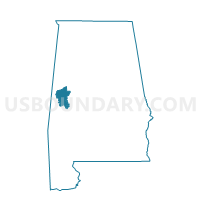
| Name | Carver School |
| County | Greene County |
| State | Alabama |
| Area (square miles) | 15.89 |
| Land Area (square miles) | 15.20 |
| Water Area (square miles) | 0.69 |
| % of Land Area | 95.65 |
| % of Water Area | 4.35 |
| Latitude of the Internal Point | 32.79269900 |
| Longtitude of the Internal Point | -87.85846690 |
Maps


Graphs
Select a template below for downloading or customizing gragh for Carver School, Greene County, Alabama


Neighbors
Neighoring Voting District (by Name) Neighboring Voting District on the Map
- Akron City Hall A, Hale County, AL
- Dollarhide Rec Center, Greene County, AL
- Eutaw Activity center, Greene County, AL
- Law Library, Greene County, AL
- Morrow-Brown Rec Center-King Village, Greene County, AL
- Sawyerville, Hale County, AL
- South Fork, Greene County, AL